
Tornado Alley Log 2019
Tornado Alley Log 2019
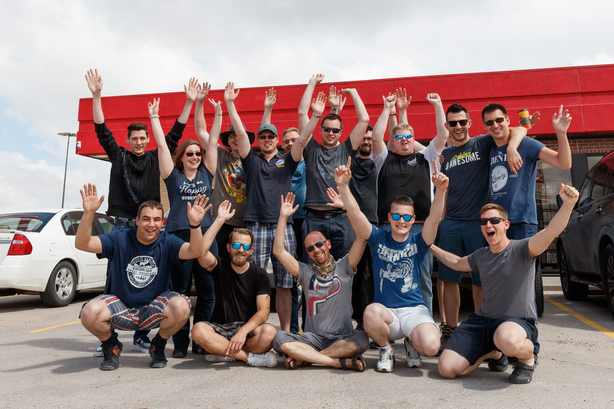
Summary of the 2019 USA trip through the Great Plains with Dennis Oswald (last week including Adrian Rohnfelder) – in large parts also with Maximilian Conrad, Maximilian Ziegler, Daniel Plätz, Jens Winninghoff, Patrick Wagner, Erik Christmann, Dr. Ingo Bertram and Dr. Michael Sachweh. For a first orientation the risk assessment (Convective Outlook) by the Storm Prediction Center (short: SPC) was added after the date. Cf. probabilistics.
Jump right in:
2019-05-20. MRGL. Snow shower and thunderstorms. 11:20 am: Start at Frankfurt Airport! Tornado Alley here we come! 1:30 pm: while Oklahoma and Texas face a “High Risk” day, we arrived at Denver airport with 1°C and snow showers. With our first stay in Lamar, CO the temperatures climbed up to 8°C with partly dense fog during our drive in the evening.
2019-05-21. SLGT. Germans under low pressure. After an overnight stay in Lamar (CO) we drove to Dodge City (KS) seeing some first weak thunderstorms and meeting up with two other chase vehicles around Maximilian Conrad, Daniel Plätz, Maximilian Ziegler as well as Jens Winninghoff, Dr. Ingo Bertram and Dr. Michael Sachweh. With an evening at Applebee’s we shared stories about Tornado Alley and the upcoming chase days.


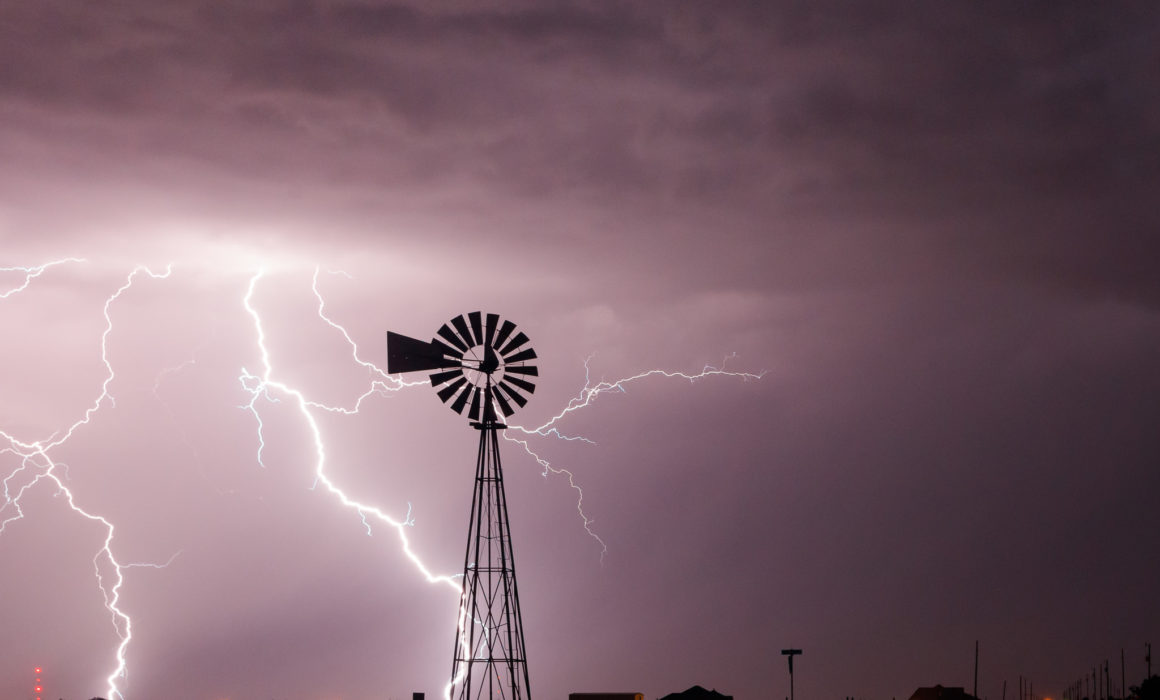
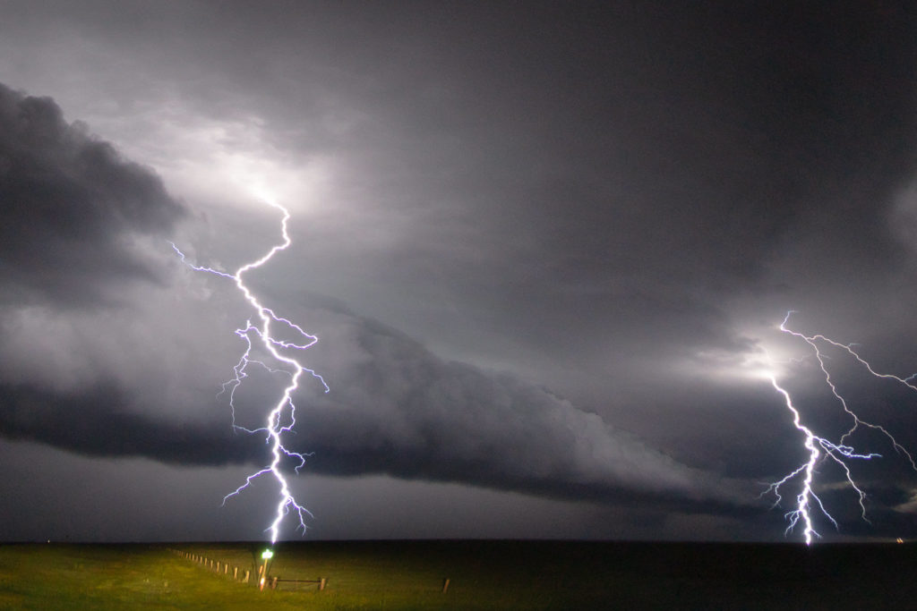
2019-05-22. ENH. Stratus und Frogs. After breakfast we started our first chase during a SPC High Risk setup in Oklahoma. We refused to chase the OKC and eastern area of the state due to floodings, trees and possible masses of chasers. After a first bust we got a weak lightshow at the Elk City Lake. The stratus everywhere caused by the wet airmass was too bad. We slept in the beautifully managed Shamrock Country Inn (TX).


2019-05-23. MDT. In the haze of the moment. First dryline chasing today. Next to Lubbock in the south of Ralls, TX we encountered a supercell with a beautiful towering updraft and a short moment of a rapidly rotating wallcloud. Overnight stay in Childress (TX).

2019-05-24. ENH. Water, haze and … haze. On our road for thunderstorms southwest of Floydada, TX we saw early convection / clustering cells. Sight on structure was almost zero most of the time. Too much moisture. And with rain came the floodings. We could capture some adventurous footage driving through the water, but left the storms behind in order to get a good view on them from a western perspective during sunset. We were stunned by the view on mammati, lightnings, rainbows and sunset colors in Cap Rock State Park. We slept at Shamrock Country Inn again.


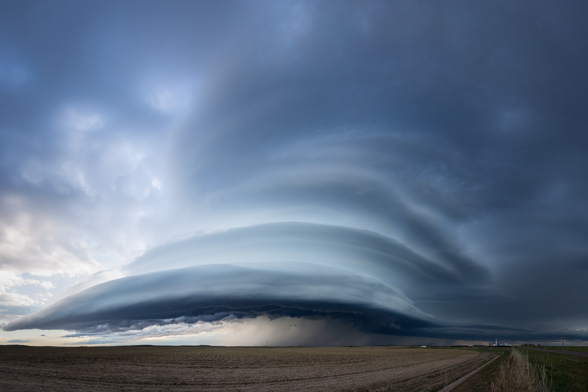
2019-05-25. ENH. With the sheriff on the viewpoint. Again (way too) early convection. We’re getting close to a tornado-warned supercell east of Quitaquec (TX). The haze was thick. We couldn’t see structure before the thunderstorm was as close as 2 miles. While waiting the sheriff came by asking us about the severe weather event approaching the town. We saw a rotating wall cloud shortly after. During our escape under tornado sirens the rotation quickly became rain-wrapped and we drove under a well-structured whale’s mouth near Turkey (TX). Some nice moments for the cameras. We slept in Shamrock, TX again.


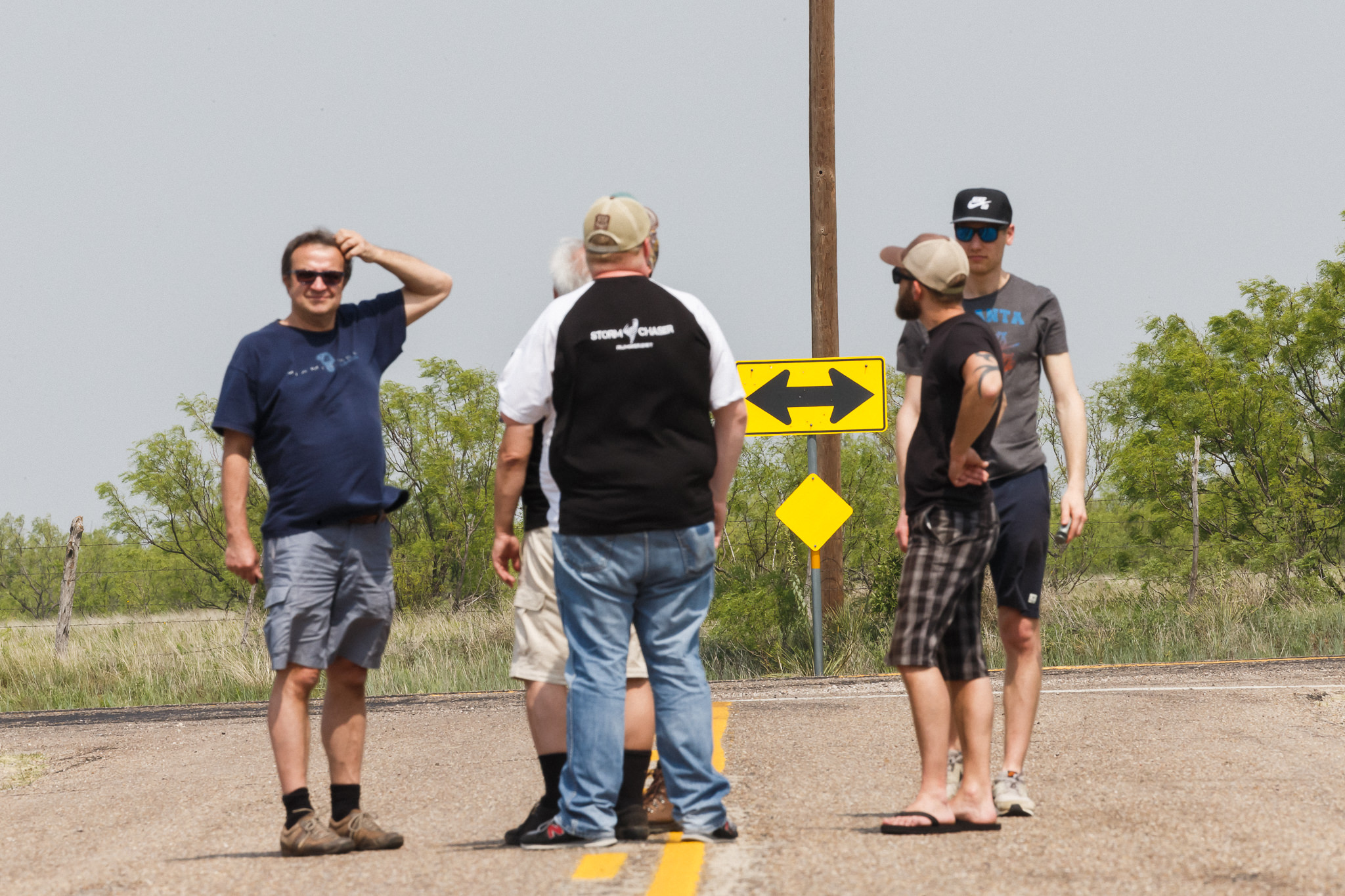
2019-05-26. MDT. The BJ’s cheeseburger tornado and massive storm chaser convergence. Driving to Lamar, CO for a moderate risk chasing. While the first cells of the day were unphotogenic, clustering and hazy as the ones from the past days we made a short stop at BJ’s Burger in Lamar to buy some cheeseburger for the whole group. Shortly after we recognized a tornado sighting via Spotter Network right in the north of the town. As we left the town behind us, we witnessed the dissolving funnelcloud near Wiley. A next cell with a rotating updraft came closer and quickly became tornado-warned. Near the graveyard of McClave we found a good viewpoint on the wall cloud which was close to dilvering a tornado. We followed an unbelievable horde of storm chasers on highway 287 and 385 until Cheyenne Wells. There we could see some pretty rapid cyclonic and anticyclonic rotating funnelclouds under the mesocyclonic horseshoe. We finished the chase with a core punch of the tornado-warned supercell to reach our Motel in Goodland. At the end of the day we’d seen two storm chaser related accidents on the road. What a shame.


2019-05-27. ENH. The chasing dead. After one week of daily t-storms we were tired but another supercellular chase day was in progress. After the weird storm chaser convergence the day before we skipped the first cell coming from Denver, CO (northeastwards). Our target southwest of Holyoke, CO was perfect. The second supercell developed during the afternoon and gave us some nice views. Unluckily, the street options were quite bad. We needed to make a big turn via Yuma and Wray to follow the cell but where overtaken by the core what made it impossible to stay upfront. The nicest mood as ‘mothership’ came only 20 miles further northeastwards near Imperial. But we were lucky to get another approaching supercell during the soft light of the evening just north of Wray. On the way back to Goodland (KS) we made some longtime eposures of the distant lightning-illuminated anvils to the north. At midnight we celebrated a chaser’s birthday.


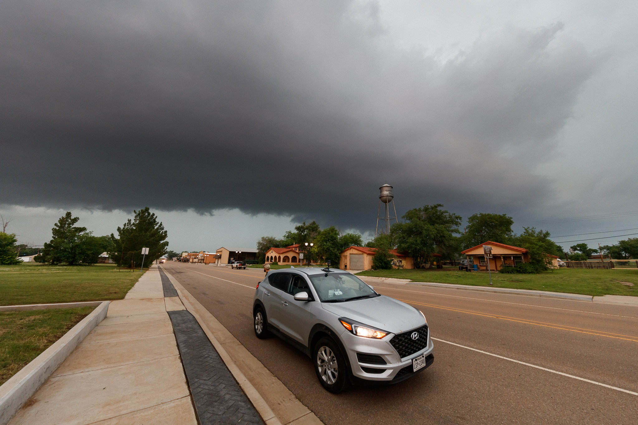
2019-05-28 ENH. The tornado close-up encounter. Tired but happy: 10 days of thunderstorms in a row. We decided to stay in northwest Kansas to chase the cold front cells instead of the dryline (which was located close to Wichita in the morning). In Oakley we met the Thüringer / Sachsen-Anhalt Storm Chaser group and made a photo together (Justin Wenk, Roy Rockman, Luise Finsterbusch, Jörg Ölsner, Dennis Oswald, Patrick Wagner, Christoph Geißler, Maximilian Conrad, Erik Christmann, Felix Dietzsch, Alex Thiel, Daniel Plätz, Maximilian Ziegler, Markus Weggässer, Ronny Kemmler and Marco Rank – f.t.l.t.r.). Shortly after that the action began. A first supercell produced several tornados in the north of Hays. We took the second one in the south of WaKeeney which had a nice wall cloud. The cell ‘swallowed’ several new developments around it and became tornado-warned. We watched the diffuse updraft region from a hill near Yocemento (KS) but were unable to see a substantial structure. So, we decided to get back on the I70. While driving to the ramp I looked to the right and saw an almost completely condensed tornado vortex next to us on the field shining like a sculpture made of glas against the light. I yelled: “TORNADO!” We jumped out of the car and took a few blurry images as the tornadic winds reached our position about 100m in distance to the vortex. That was crazy close. We fled 300m to the south passing the sheriff and some locals viewing this spectacle aswell. Then we saw the whole tornado behind us as it came closer again. We needed to flee further. At the interstate ramp we finally saw the tornado roping out on the field. It was a type II tornado which had developed under the flanking line of the storm (almost “out of the blue” so to say). Near Hays the storm weakened and became outflow dominant. We stopped the eastward chasing and approached a last cell to our west. This one died pretty fast due to the already consumed airmass. We finished the day with a core punch and rainbow next to the Ellis’ water tower.


2019-05-29. After staying in Hays overnight we had a pure driving day to Guymon (OK) and Burgers at REFZ sportsbar.
2019-05-30 MRGL. Relaxing between snakes, lizards and the roadrunner. Driving further southwest to Amarillo. Today was an off-day in order to relax and gain some strength for the second half of the trip. We met the Thüringer Storm Chaser group and meteorologists around Jens Winninghoff and Dr. Ingo Bertram again for a joint hiking to the Lighthouse Rock in Palo Duro State Park. On our way back to the motel in Amarillo we saw some lightnings near Canyon (TX) and a Whataburger at the end of the day – LOL.


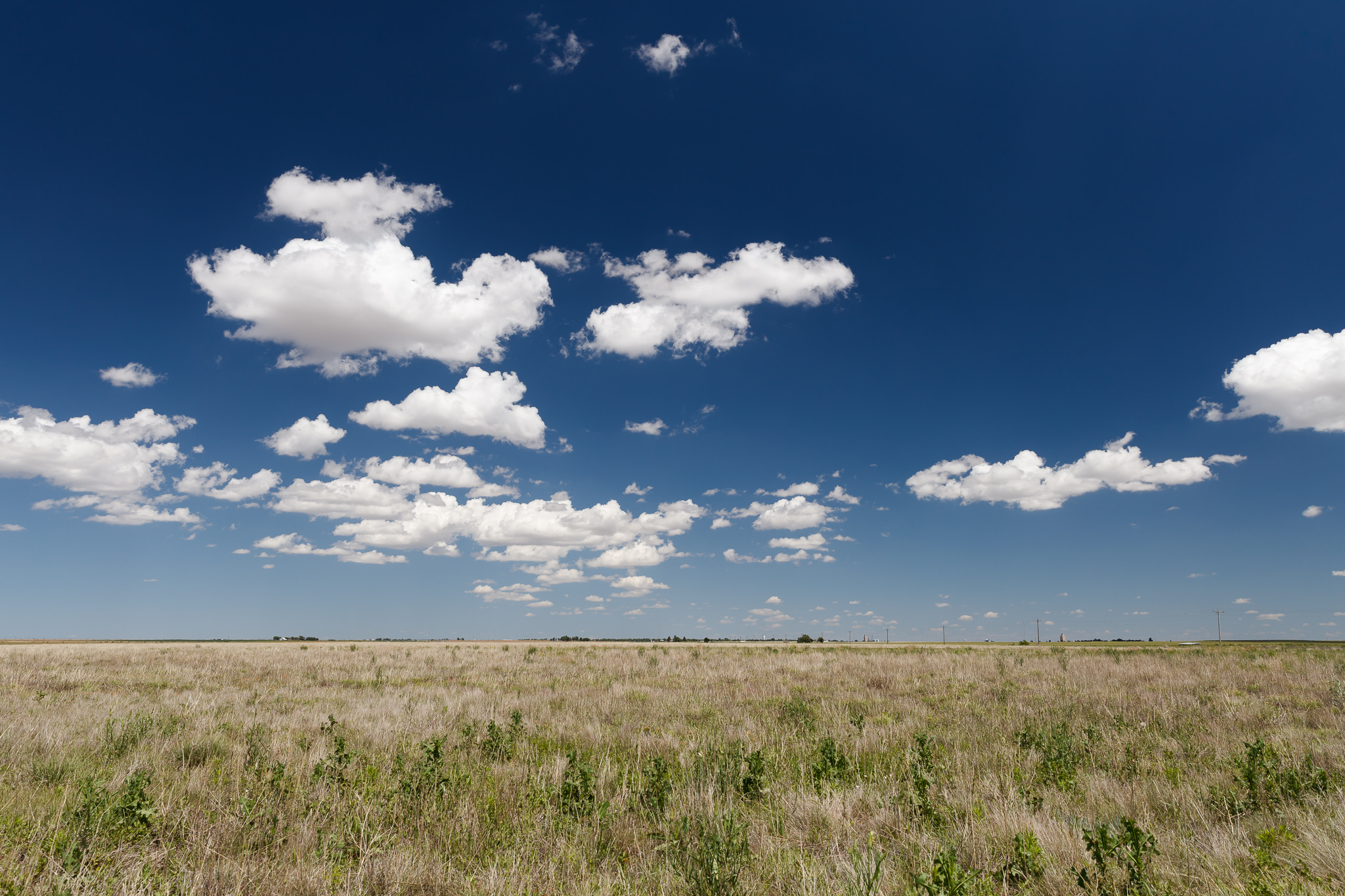
2019-05-31 TSTM. Cumuli and blue sky. Another day of repositioning and relaxing. All the driving and lack of sleep was exhausting. We watched the cumulus clouds and some dust devils somewhere on the fields next to Boise City (OK) to finally reach our goal of the day: Lamar (CO). BJ’s Burger again? Oh yes please!

2019-06-01. MRGL. Washing day. We drove to Limon (CO) and washed our clothes (1 hour, $5) at first. Due to lack of detergenthad we used a fragrance dispenser instead. Between Agate and Limon we got a nice view on the Rockies and first cell developments. There we met Steffi Dettler, Jonas Piontek and Jaxson Pohlman an chased a cell with a decent rotating updraft over Punkin Center, Ordway, Eads to Lamar. While following it the storm clustered quite soon. A triggering convergence brought some outflow-dominant but photogenic structure to the evening. Overnight stay in Lamar with BJ’s Burgers – for sure.


Jonas ordering at BJ’s 
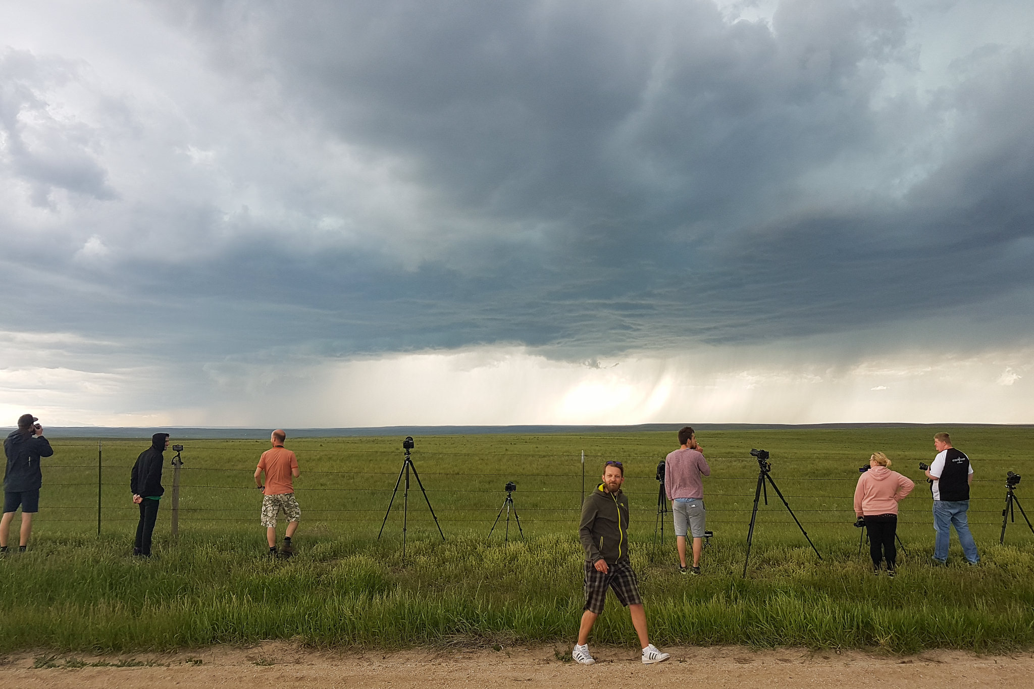
2019-06-02. SLGT. Shelf cloud and cool drinks. Waiting for storm initiation west of Lamar. After shopping at Walmart we relaxed and watched birds in Willow Creek Park. Cells developed west of Springfield and looked weak at first. We decided to go for the tail-end-charlie. Good choice – our storm got stronger. In the west of Boise City (OK) we could observe the now “severe” warned cell together with researchers from Mesonet and Torros. Later the storm produced a nice shelf cloud during the blue hour (together with the tracks in front near Stratfort a great scenery). In Stratfort we stopped the chase and got back to Boise City, where we stopped once more for pictures of the anvils with the starry sky. Jens and Ingo wanted to say goodbye in the evening and waited for us in the motel. At 11:45 pm nobody opened us for our checkin, contrary to our expectations. So we had to look for a new place to stay for the night, which we luckily found in time. Jens and Ingo gave us their cooler as a farewell gift. So from now on cool drinks in the car – yes!


2019-06-03. SGLT. Trunk coffee. Ride up to our viewing hill near Limon (CO). Early initiation with many cg lightnings. Successive shift to the east. At Genoa we took pictures of the storm with train and lightnings. At a rest area near Arriba Dennis made us a coffee in the trunk. Afterwards we saw upward lightning. Last stop in Seibert where we ran into Patrick and Erik (both left the Plains the next day for the Rockies). Adrian Rohnfelder arrived in the evening with via rental car at our motel in Limon (CO).


2019-06-04. MRGL. The wave. Drive to Denver to drop off Adrian’s rental car. Then we reached the first cell of the day at Limon (CO). An increasing storm with an amazing waveform of the base at Punkin Center led to a meeting with the tour of Mike Olbinski and Brett Wright. We drove further to the east and met Max, Maxi and Daniel on the road following the cell via Kit Carson to Eads. Finally in the evening we returned to Lamar and had some burgers (CO).


2019-06-05. MRGL. Black Hills Blitze. Abschied von Maxi, Max und Daniel. Wir fuhren von Lamar (CO) nach Rapid City (SD). Abends wurden wir von den Black Hills mit Gewitter begrüßt. Übernachtung im Super 8.


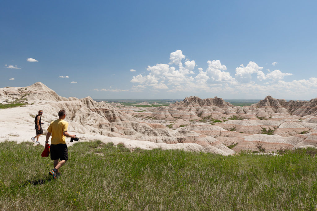
2019-06-06. Milky Way over the Badlands. Breakfast at Denny’s and visit of the Badlands National Park. Bighorn sheeps, bisons and various birds. A bizarre and in the changing light very different looking porous landscape. We enjoyed the sunset atmosphere and took pictures. My initial Milky Way photography led to a short dispute about planning and priorities. After all, we had an important day ahead of us.


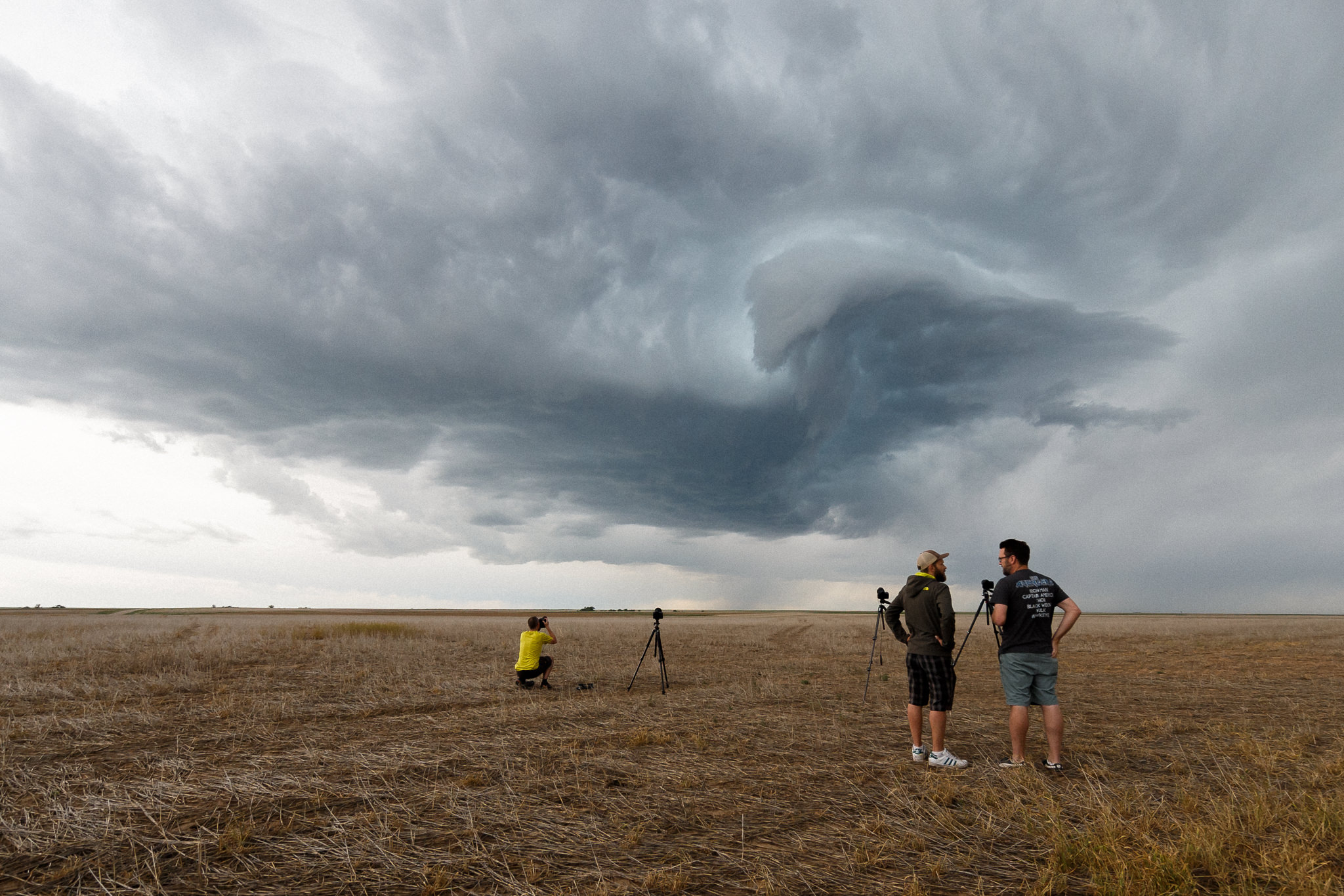
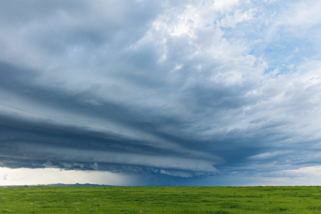
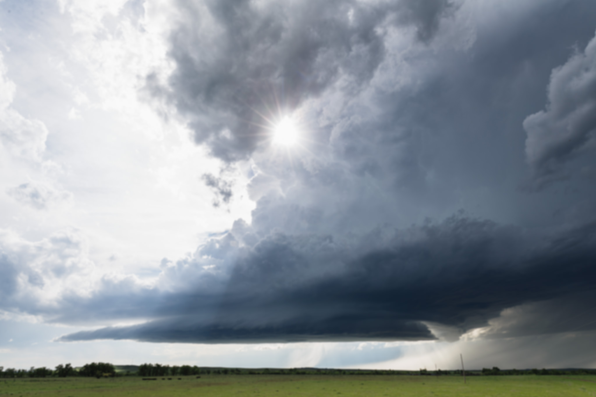
2019-06-07. ENH. Montana Magic. After breakfast with our own bread we headed to Moorcroft (WY) to wait for a first storm. At “Heidis Deli” we had excellent sandwiches. A short time later it storm went of a little more to the north than planned. We quickly followed the shifted situation and reached an LP supercell “just in time” near the Devils Tower, which convinced us structurally. At Albion (MT) we were unfortunately unable to follow the magnificent cell due to a private road. A subsequent cell resulted in a beautiful shelf cloud directly afterwards. On the way back to Rapid City near Colony (WY) we saw a strong storm that had a rotating updraft for a short time and was a lot of fun concerning lightning. Afterwards we met Jane, Clyve and Thomas Hinterdorfer (Australian Storm Chaser). Since Rapid City had unexpectedly many sports events that evening, the overnight prices with 100-150$ were much more expensive than usual (50-75).
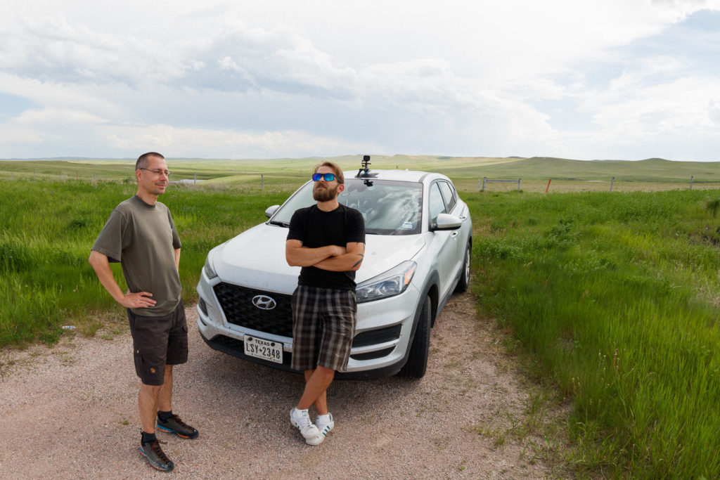


Albion, Montana, USA


2019-06-08. SLGT. The Sheriff’s tornado photo. We drove 500 km south to Goodland. It was questionable if we could make it in time. But we managed to get through the closing gap between two thunderstorms with a little hail punch. From Goodland we were able to observe two funnel clouds at the previously overtaken cells. Later pictures of other chasers clearly showed that these were two landspout tornados. Gradually, the tornadic cells left. We decided to go to the west side to photograph their updrafts. The decision making was difficult. West of Goodland we met the sheriff who showed us his perfect tornado photos. Shortly after he had left us, the thunderstorm line for the evening appeared above the Rockies. Those should reach us far after sunset. The HRRR continued to compute another initiation for our position. All of a sudden a huge updraft tower went up. We made time lapses. The developing base was very turbulent. Many times dust was whirled up. With the tornado warning for the cell we finally left and followed. The road to the south was long without a suitable east option. Quickly the updraft was wrapped by the RFD. The more south we drove, the less we saw. Since overtaking the cell from the east seemed questionable, we stayed in the west and drove a little bit back towards Goodland with the best possible view of the back. Time lapse showed clear rotation under the updraft which we still had visibility on. With the sunset the powerful cloud-to-ground lightning discharges became more visible. We took pictures and were impressed by the cell’s local stability. It rotaed northwest of Winona on the spot and only after a while made progress to Russel Springs. The velocity scan indicates a massive mesocyclone with possible tornado. Meanwhile, new developments suddenly appeared above us. CG lightning got dangerously close. We swerved a bit to the south and observed the new development. This cell, the radar later showed, overtook the supercell at Russel Springs and made a massive south-easterly leap to Scott City. A tremendous chasing day with some learning lessons. Summary: 1. don’t stop in the city when observing, always keep an eye on the landscape. 2. decide what you want to see: tornadoes / updraft structure? – then don’t let the backside or other photogenic subjects distract you and drive up consistently. 3. overtaking a stationary or slow-moving cell is worthwhile – rather try than break off too soon.


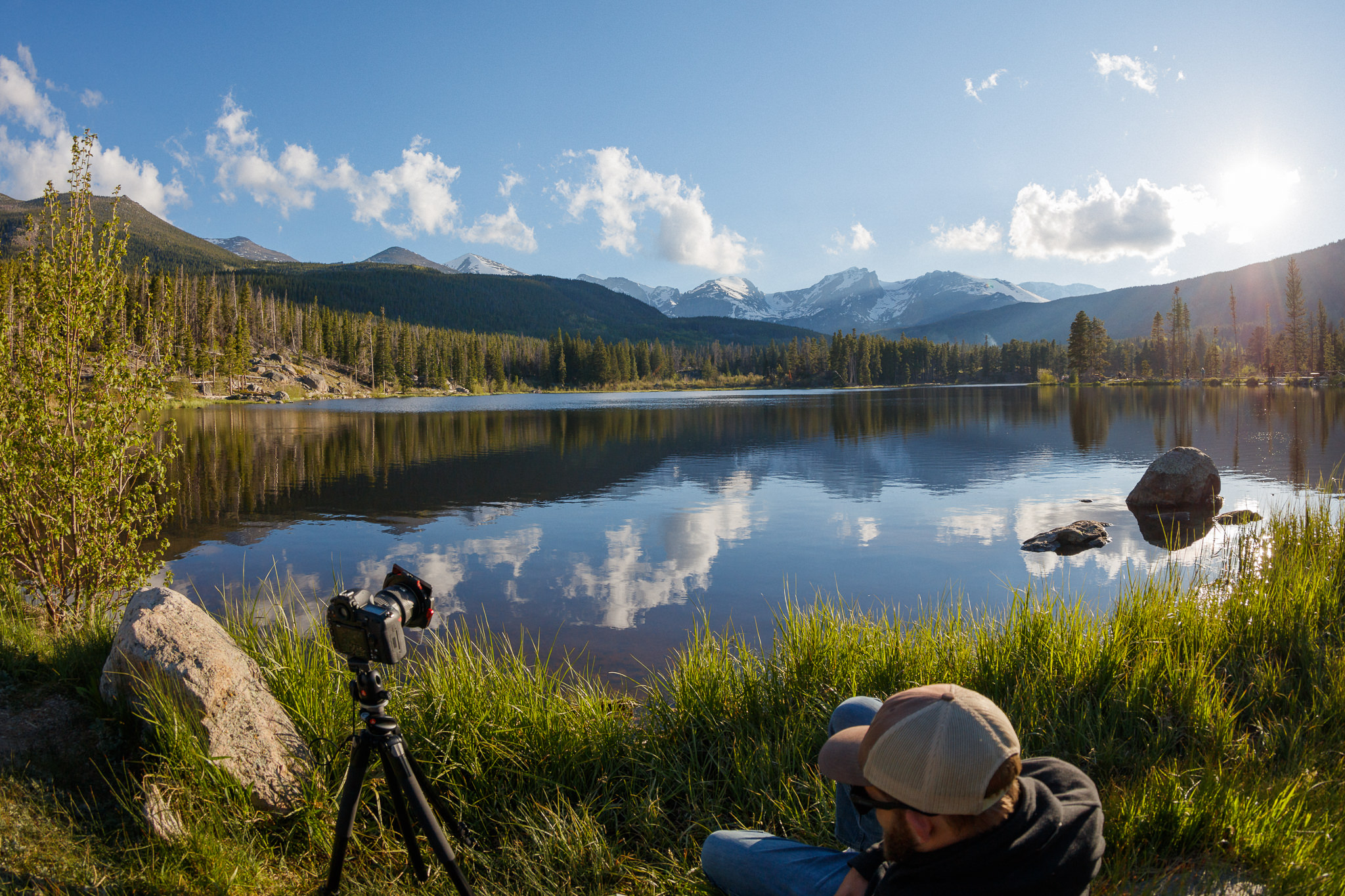
2019-06-09. Resting in the Rockies. After doing the laundry we drove to Estes Park. Check in at a cosy motel. Sunset at Sprague Lake in Rocky Mountain National Park. Moose, deer, hummingbird. Great end of the trip!
Dinner at Diner. Last day in Denver (CO). Car cleaning, dinner at the diner and overnight stay in a questionable motel. Return flight on 11.06.2019.

For older Tours click here: